
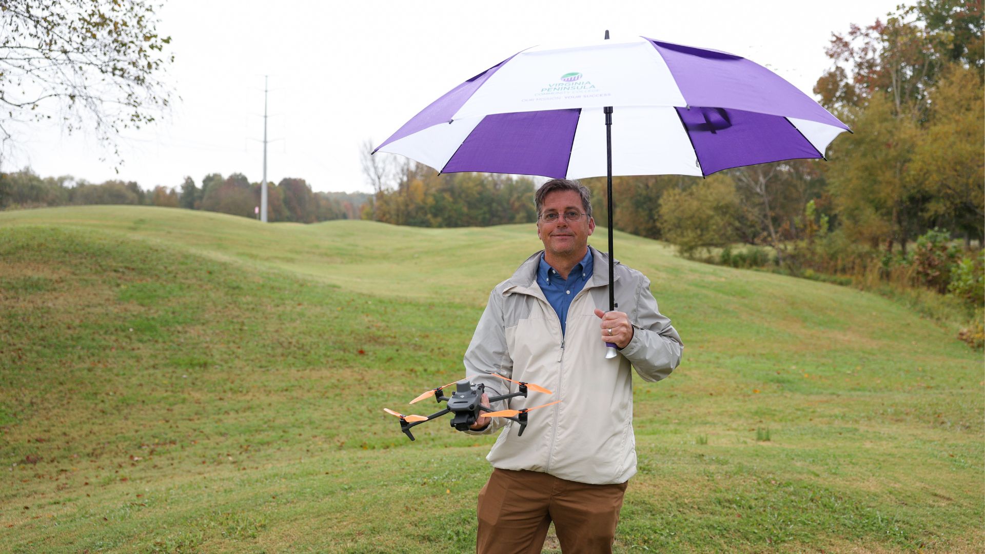
When Michael Robinson launches a drone over a construction site or a landscape in Hampton Roads, it’s not just a piece of technology taking flight. It’s a return to lifelong interests for him and the peak of a career.
Robinson completed Small Unmanned Aircraft Systems (sUAS) studies at Virginia Peninsula Community College in 2024. Soon after, he started a drone services business, offering everything from real estate photography to construction documentation and advanced aerial mapping.
He was plotting his course to entrepreneurship before drones became commonplace.
With a bachelor’s degree in geography and geographic information systems (GIS) from Arizona State University in hand, Robinson landed his first job right out of college. It put him directly into the world of aerial imagery, working for a company that captured aerial photographs and “stitched them together” to make detailed maps. He said the company was ultimately sold to Google Earth.
“That was my first experience with aerial imagery and photography. Then I had a few different jobs in GIS and doing different things with maps and a lot of satellite imagery kind of jobs,” he said.
He built a career around geographic information systems, satellite imagery, and location-based data. He spent nearly a decade in the telecommunications industry helping plan fiber optic networks as a design-side engineer after his first job. The work required constant interaction with maps, addresses, cable routes and high-resolution imagery. Those skills later translated seamlessly into drone operations.
Robinson shifted gears again, leaving the telecom field for real estate investment and house flipping. He was also a full-time father at the time, managing schedules for his two young children (now ages 7 and 8) while his wife maintained a demanding career.
During this transition, he discovered sUAS courses offered at VPCC and enrolled in January 2024. He attended most classes in Williamsburg, where he lives, and some in Hampton, earning a certificate that July. He said the program’s hands-on approach and strong focus on safety were central to his success.
“They really emphasized safety and regulations,” he said. “Flying near airports, navigating restricted airspace, especially around Langley and the military bases here, you have to know exactly what you’re doing.”
Of the program’s offerings, one class stood out. In the automated drone mapping class, Robinson learned to create orthomosaic maps — highly detailed aerial surveys that can be layered with GIS data. For his final project, he created a map projecting sea-level rise across the Hampton Roads region 50 years into the future.“That project really showed how powerful this technology can be,” he said. “You’re not just taking pictures. You’re creating data people can actually use.”
Today, that idea drives his business. He provides aerial photography for real estate, marketing, landscape management and special events, including projects in Colonial Williamsburg. He noted the historic region is an area where drone access is rarely granted. Robinson also works with insurance companies and construction firms, documenting development progress through weekly drone flights.
“Construction documentation is huge,” he said. “Developers want to see how projects are progressing without having to be on site. Drones make that efficient and affordable.”
Among his proudest accomplishments are mapping his entire 156-acre neighborhood for real estate applications and securing a multi-week construction contract in Chesapeake. Still, Robinson admits, the most challenging part of entrepreneurship isn’t flying. Finding clients is a lot of work.
“It’s about timing, networking, and honestly, a little bit of luck. You really have to put yourself out there,” he said of attracting clients.
To that end, he stays busy attending conferences, networking on social media, and even representing VPCC at local events and air shows. While growing his business is a high priority, he’s also interested in building a local network of drone pilots who can compete with national firms.
Robinson is excited about ever-changing technologies, including LiDAR and centimeter-level surveying accuracy. He envisions a future where drones can perform highly precise surveys for builders, eliminating the need for time-consuming ground measurements.
“There’s so much potential,” he said. “This technology is still evolving, and that’s what makes it exciting.”
Originally from Boulder, Colo., Robinson graduated from Fairview High School and his career led him across states and industries. Family ties eventually drew him to Hampton Roads. His grandparents lived in Hampton, where he often enjoyed holiday visits during childhood. After time in Charlottesville, he and his wife settled in Williamsburg, drawn by proximity to the water, “outdoorsy” activities and a lifestyle well-suited for raising a family.
He shared sound advice for anyone seeking a future in unmanned systems. Robinson says stay curious and stay connected.
“Taking the class is just the beginning,” he said. “You have to keep learning, keep networking and think big. This field can take you anywhere from running your own business to working for a major company or even NASA.”
For Robinson, the view from above is about perspective and, most of all, possibility.